Видимо на нейтральной, т.е. более 20км от берега.
Парадокс ещё и в том что только с аппаратуры этого спутника, Landsat 7, хорошо
просматриваеться рельеф дна всех водоёмов на земном шаре. Смотрел снимки с разных других спутников, в том числе и по ссылке alex,
хорошо видны в водоёмах только: планктон, водоросли, речная муть, отражающая поверхность воды и всем этим закрыт просмотр рельефа дна.
Для получения с Landsat 7 фоток, более качественных (и большего разрешения), чем общедоступные нужно платить от 30 до300$.
Основные параметры спутника Landsat 7 кратко:The ETM+ instrument provides data from eight spectral bands (band designations). The resolution is 30 meters for the visible and near-infrared (bands 1-5 and 7). Resolution for the panchromatic (band 8) is 15 meters, and the thermal infrared (band 6) is 60 meters. The approximate scene size is 183 x 170 kilometers (115 x 106 miles). The following levels of correction are available to the general public:
Raw Uncorrected (Level 0R) has had no radiometric or geometric correction applied. Scan lines are reversed and nominally aligned.
Radiometric Correction (Level 1R) includes radiometric correction, but no geometric correction. Scan lines are reversed and nominally aligned.
Systematic Correction (Level 1G) includes both radiometric and geometric correction. The scene will be rotated, aligned, and georeferenced to a user-defined map projection.
The following levels of correction (including SLC-off products) are available to approved USGS researchers only:
Precision Correction (Level 1P) includes radiometric and geometric correction, as well as the use of ground control points (GCPs) to improve accuracy. For locations outside the U.S., the availability of a precision-corrected product will depend upon the availability of local GCPs.
Terrain Correction (Level 1T) includes radiometric, geometric, and precision correction, as well as the use of a digital elevation model (DEM) to correct parallax error due to local terrain elevation. For locations outside the U.S., the availability of the terrain-corrected product will depend upon the availability of local ground control points (GCPs), as well as the resolution of the best available DEM.
Landsat7 home page Landsat 7 Science Data Users Handbook URL:
http://ltpwww.gsfc.nasa.gov/IAS/handbook/handbook_toc.html NOTE: SLC-off Data Products
An instrument malfunction occurred onboard Landsat 7 on May 31, 2003. The problem was caused by failure of the Scan Line Corrector (SLC), which compensates for the forward motion of the satellite. Subsequent efforts to recover the SLC were not successful, and the problem appears to be permanent. The Landsat 7 Enhanced Thematic Mapper Plus (ETM+) is still capable of acquiring useful image data with the SLC turned off, particularly within the central portion of any given scene. Landsat 7 ETM+ therefore continues to acquire image data in the "SLC-off" mode. The U.S. Geological Survey (USGS) Earth Resources Observation System (EROS) Data Center (EDC) released Landsat 7 ETM+ SLC-off data products, effective October 22, 2003. This product release includes all image data acquired by Landsat 7 in SLC-off mode from July 14, 2003 to present, excluding a 2-week interval from 9/3/03 to 9/17/03. The SLC-off data products are distributed as standard Landsat 7 single scene (WRS-2) and multi-scene products.
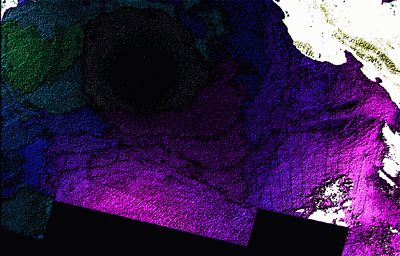
Ещё вот, вариант обработки через фильтра. Формат фото GIF: 400x256 пикселей, разрешение по горизонтали-вертикали 96 точек на дюйм, глубина цвета 8 бит.
Это сообщение отредактировал radmar - 23.06.2005 - 08:12
Присоединённое изображение
 Главная
 Помощь
 Поиск
Поиск
 Участники
 Календарь


 Страницы: (8) Все 1 2 [3] 4 5 ... Последняя »